Being as tough as it already is, snow adds another level of complexity to running Desoto, luckily we ran the trail north starting just outside of Cleator, AZ and the snow was almost gone except for the shady places on the trail. Running the trail north towards Mayer, you’re going to hit most of the harder parts of the trail down hill.
Forest Road 259B, or the trail you’ll need to take all the way from Crown King Road to Desoto Mine looked like it was freshly graded by the farmer to access their cattle back there, we saw a plenty of cows and the farmer’s truck right outside of the mine. We also saw the farmer inside checking on his water pump, guess that’s how he gets water to his cows.
Once we got to the mine, a hand full of us went inside while the rest hung out by the cars outside. The entrance to the mine was about wet as it usually is, but surprisingly the sharp left turn you make way down in the tunnel was also under water, I’ve never seen water cover the tunnel that far back. Luckily, someone stacked old timber logs and rocks so we could get across without much trouble.

The mine itself is still in pristine shape, it looks like the miners might have just packed up and left, if it wasn’t for the beer cans left behind by some a-holes I mean explorers. This time around we lost a track of time exploring the mine, and went back and up to levels I haven’t been before. Mike’s friend, Mike(squared) led the way up some sketchy ladders to an upper level I’ve never been to, and boy were the sketchy ladders worth the climb. We came across a giant room in the mine, with ladders hanging up a 200 foot cliff inside the mine, as well as ladders going further up at an angle way up, probably towards the other entrance of the mine up top, we felt a strong breeze blowing up that way.
We lost track of time exploring the mine, once we got out of it, the group waiting outside was jonesing to get going. We took off towards Forst Road 9268R.
The views with Sunset Point Rest Area and Agua Fria National Monument in the distance were nothing short of incredible.


Optional Obstacles
Once we dropped into the valley and ready to hit Forest Road 9268R, a few of us played around the optional obstacles. Curtis came down and back up it without much of a problem.

Jack on the other hand scared the living crap out of us, but made it down the obstacle without any damage.


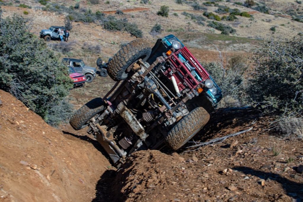
Then it was Brian’s turn in Jim’s old Suzuki Samurai. Jim’s Samurai may have been to the moon and back, the lack of straight body panels suggests it. Brian had a hell of a time trying to make it up optional obstacles, picking the right line got the best of him and he ended up on the side every time he would try.


With going back down not really an option because of the boulder blocking the driver side rear of the car, Curtis took a swing driving Brian’s Samurai up the obstacles, but he wasn’t having any better luck and ended up on the side a few more times. I figured Curtis could make it up without a problem, but just the ever so slightly different set up Brian’s rig made the obstacle impossible to climb.
With day light burning, Curtis managed to back the Samurai to the flat ground, where Brian went to explore the damage, check fluid levels and get the Samurai ready to continue up the trail.


Starting Forest Road 9268R
The trail got bit rougher once we hit Forest Road 9268R, the first climb up hill was in a really good shape, but got a little worse once we were ready to hit the next major climb. Looks like the farmer maintains the road back there to access the cattle tank.
Ridgeline Trail with the big ledge
We came up to the hill with the stair step at the top, I was able to maneuver my Grand Vitara around it with and come down the rest of the hill without much trouble, but going up I have a feeling I’d loose a CV shaft or two.
Here are a couple of shots from the drone of the rest of the group descending the hill.


Forest Road 202 Closure
We then jumped on Forest Road 202 and saw signs that said the road was closed…. Going back up the hill was not an option so we continued on. It makes no sense why that connector trail would get closed.
I remember Bobby reaching out to the forest service about this but I’m not really sure it went anywhere.
Forest Road 389
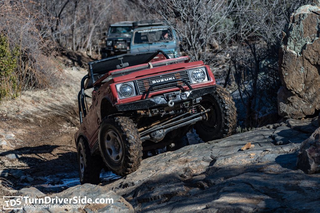
We then jumped on Forest Road 389 which connects to Forest Road 89. Going up Forest Road 389 out of the valley was a bit rocky, but the remainder of the trail was in a descend shape, with a plenty of play areas for the group to get their rock crawling itches out.


James even had a chance to air his Grand Vitara out.
